The Cartographic Mode of Production and the Map’s New Mask by Dennis Wood

The Cartographic Mode of Production and the Map’s New Mask
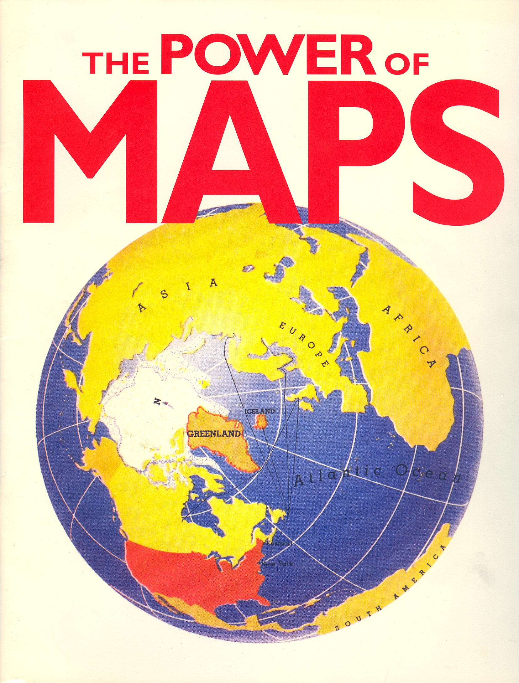
Back in 1992 I gave a talk called “How Maps Work.” It was to inaugurate the Power of Maps exhibition at the Smithsonian’s Cooper-Hewitt National Design Museum.[i] I began it by pointing out that maps are weapons in the fight for social dominion; weapons that are disguised as representations of the world but that in fact link territory with its entailments (school attendance zones with place of residence, tree species with degree of slope). Maps do this by posting multicoded signs to a common plane (that of the map), and in doing so create a world they pretend to no more than…observe.
This makes the map a potential target for every form of resistance and because of this the map enters the world masked.
These masks are apparently manifold. For example, there’s the mask of singed paper and curled edges worn by the treasure map on the back of the cereal box to pretend it wasn't printed on a 100,000 cartons of Cheerios the day before yesterday. Or the mask of this year’s colors and copyright that tries to smooth away the wrinkles that date the maps in high school geography and history textbooks. There're the masks of elaborate cartouches still struggling to recover from the chill that blew in with lithography and serious mass production; and the mask of reliability diagrams and UTM grid ticks implying a precision maps rarely have any reason to call upon. There're the jokey exaggerations tourist poster-maps exploit to obscure their advertising function; and the mask that cautions, “There is no assurance all vertical obstructions greater than 200 feet have been reported,” by which airline pilots are nonetheless not afraid to fly.
These masks are all sleights. They’re designed to divert our attention from the real mask, the mask worn beneath them that no map dares to pass without. This is a mask of words and shrewdly encouraged self-deceptions, of definitions and smoothly elaborated misconceptions: it’s the pretense that maps no more than observe the world they create, no more than inherit the categories they invent. This affectation of being a detached observer – an observer blessed with unbiased disinterest – is what most makes a map a map, is ultimately what differentiates the map from other graphics that describe the world, from billboards, from paintings, from fine art prints. As out of costume Spiderman is just another high school student, so without its mask of neutral observation a map is just another drawing, just another offset litho.
Unlike the other masks, this mask is not inscribed on or over the surface of the map, but is constituted by the “games” in which the map is the “game board,” for the map is the authoritative register in which the social meets the territory (they meet on the plane of the map). In other words, the map is a vehicle for creating and conveying authority about and over territory. Its authority is the social manifestation of an intrinsic and incontrovertible “factuality” created by the social assent given to the propositions the map embodies. These propositions take the form of linkages among conditions, states, processes, and behaviors conjoined through the territory, and are realized through postings to the sign plane of the map. Postings are the fundamental spatial/meaning propositions – assertions that “this is there” – out of which the map is composed.[ii]
That is, maps have the authority that we grant them by overlooking the fact that we do so. This is a form of repression, but aside from the map’s pretense to present the world as it really is, what claim could it possibly have on our attention?
The authority we grant maps is enormous. In the issue of the Annals of the Association of American Geographers that just crashed into my mailbox were no fewer than four articles detailing exactly how enormous this authority is. “Mapping Spaces of Environmental Dispute: GIS, Mining, and Surveillance in the Amazon,” probably needs no further elucidation.[iii] Nor do “Don’t Fence Me In: Boundaries, Policy, and Deliberation in Maine’s Lobster Commons,”[iv] and “Rethinking the Study of International Boundaries: A Biography of the Kyrgyzstan-Uzbekistan Boundary;” though the latter’s claim that “the boundary itself was not a mere product of the Soviet Union: it helped produce the Soviet Union. It was not a more precise realization of imprecise frontiers between Uzbek and Kyrgyz peoples. It helped create Soviet Uzbek and Kyrgyz peoples,” probably merits underscoring.[v] The place of the map in “With Numbers in Place: Security, Territory, and the Production of Calculable Space” may be less obvious but with the assertion that, “The GPS navigation systems used for everything from emergency response to pizza delivery only work by linking a set of geographical coordinates to an official street address,” it’s plain that it’s the map that keeps it all in synch.[vi]
The masks that make it possible for the map to continue doing all this heavy lifting – that is, to continue to pass as descriptions of the real and so command obeisance – are growing worn. Not worn out – they’re still generally effective – but here and there they’re beginning to get so thin that people are beginning to be able to see through them. I mean, there are thousands of artists these days – literally – who make a practice of ripping the masks off maps. There’s a blossoming community of critical cartographers whose first reflexive action is to question the map’s authority. And more and more people are taking the map into their own hands and bending it to their own ends. These unmasking activities threaten, howsoever modestly, to undo a five-century investment in making the map the authoritative instrument of power it remains, and this calls for new masks.
That is, now that we’re beginning to be able to see through the old masquerades that maps are just pictures of the world, just tools to help us get around, just “evocations of place,” new masquerades have to be dreamed up. A masquerade that’s gained momentum with startling speed is the idea that maps are just, you know, fun. Academics are referring to this as a “ludic turn,” but whatever you call it, by positing maps as a source and form of pleasure it injects map-thinking into our consciousness more deeply and more comprehensively than ever before.[vii] In so doing it makes legible to any with the means to see ever more of our lives, indeed, ever more of our individual lives.
Some of this amounts to no more than a trivial extension of old fashioned map-based board games – think Risk, think Avalon Hill’s war games – into, say, initially, city- and other environment-buildingsimulationvideo games like SimCity and SimEarth (1989 and continuing); then into massively multiplayer online role-playing games like World of Warcraft (1994 and continuing); and currently into first-person shooter games (and third-person shooter games) like Treyarch’s Call of Duty franchise (2003 and continuing). Individually these games have all been popular – and profitable – but taken together the video game business this year will account for over $70 billion in sales (this dwarfs things like the film industry), an enormous chunk of which are map-based. Given this immersion in maps a question arises: how long will it be until it’s impossible to think of the world except through maps?
Yet much of this new map fun has little or nothing to do with the old-fashioned board-game model but instead, via the map, turns the world itself into a playground. Fundamental here is the nearly universal online presence of Google maps (or its clone, OpenStreetMap). You can’t imagine how badly you need a map until you visit sites like “Google Maps for Mobile” or “Google Maps API Family.” Here: “Maps API for Flash: Use this ActionScript API to embed a Google Map in your Flash-based web page or app. Manipulate the Map in three dimensions and add content through many services,” or, my favorite, “Google Earth API: Embed a true 3D digital globe into your web page. Take your visitors anywhere on the Earth (even below the ocean) without leaving your web page.” Now it’s no longer that I don’t have to go outdoors, it’s that I don’t even have to leave my webpage!!!!
At a very fundamental level this is insane, but more superficially it promotes a level of silliness that utterly trivializes the role maps play underneath all the fun. “I Just Made Love” is a perfect example of what I’m talking about. This is a site that, as it says, “shows on the map places where people just made love.” When you land on the site, a map of the world is displayed – need I add that it’s a Google map? – along with a pane that reads, “The website ‘http://Ijustmadelove.com’ would like to use your current location.” To encourage you to let it do so, a pop-up on the site itself says, “Look up up up, see that nice little grey bar asking very politely to allow IJML to locate you? No? Look again! See it now? Good, now accept it.”
When I do so, the world zooms to Raleigh, North Carolina. Zooming further I find that the map has been pinned a couple of blocks from where I’m sitting. If you click on the pin (blue pins for gay sex, pink for lesbian sex, pink-and-blue for heterosex) a window opens with the date, a comment (“NC State chick sucked my dick last night”), a little figure indicating the reporter’s sex, little figures showing the position(s) (in this case a pink figure kneeling in front of a blue one), and a pictogram to say it was indoors (a couch in this case, but it could have been a car, boat, plane, whatever). There’s a window to type in an email address should you wish to spread the contents around. “Get Your Own Love Stats,” it urges: “Create personal love map/ Compare your love stats with the whole world/ See how people make love in your area.” The English isn’t perfect – it’s a Polish site – but the ideas are adequately clear. And the fun? It just keeps on coming.
Of course you don’t have to let the site use your location – you can go to wherever people have posted making love (few in Inner Mongolia, tons in Beijing) – but there are websites that make no sense at all unless you do let them use your location. These last mark an especially interesting shift, because they exploit your location to make them money. Foursquare is a...location-based...social networking site … for mobile devices. “Location-based” means it’s map based.[viii] You “check in,” that is, let foursquare use your location and, well, here’s how foursquare puts it: “Millions of people check in on foursquare every day to meet up with friends nearby, keep up with friends around the world, and share their experiences through photos and comments.” It’s that first part, checking in to meet up with friends nearby, that really requires letting the site use your location, your constantly shifting location, you and your friends. Millions do this. Of course, if you check in you can “save money and unlock rewards”: “With foursquare Specials, get savings and rewards at your favorite places. Check-ins can earn you 20% off your bill, a freebie for bringing your friends, or even a special parking spot for being the ‘Mayor’.” What makes it especially fun is, “With foursquare, you'll unlock badges for the things you do in the real world. Collect as many as you can and compete with your friends.” Foursquare says I need a passion for exploration: what foursquare means is that I need a cellphone and their app.
So what’s going on here? If you Google foursquare you can click either on the site’s homepage or on “Foursquare for business.” There it says: “Millions of times a day, people use foursquare to check in and share where they are. Whether checking out a new restaurant, meeting up with friends, or visiting a favorite boutique, they are chronicling and sharing their adventures. As a business or brand on foursquare, you can be a big part of that experience.” You can follow the links to your endless opportunities or you can Google “monetizing foursquare.” There I got 1.3 million hits but stopped scanning after the first 50. Everyone of them was something like “Monetizing foursquare: An Interview With Co-founder Dennis Crowley” or “Comparing Instagram and foursquare.” The lead into this last goes: “If Instagram is worth 1 billion dollars, then surely foursquare could command a similar sum.” Okaaay...
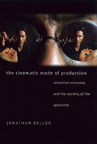
So? Maps have always been about making money. That’s another thing that’s been hiding under the mask, way under it. And...big news. But with foursquare, maps enable you to make money for them while everybody pretends it’s just fun. That is, pretends it’s not work. But if it’s not work, what’s generating the money? The billion dollars? Thin air? In his really terrific, The Cinematic Mode of Production: Attention Economy and the Society of the Spectacle, Jonathan Beller argues “that looking is posited by capital as labor”:
What I will call “the attention theory of value” finds in the notion of “labor,” elaborated in Marx’s labor theory of value, the prototype of the newest source of value production under capitalism today: value-producing human attention.... At once the means and the archetype for the transfer of attentional bio-power (its conversion into value and surplus value) to capital, what is meant today by “the image” is a cryptic synonym for these relations of production.[ix]
What Beller’s saying is that attention to images is harvested as capital, which is exactly what foursquare is doing with...location. You tell foursquare where you are and foursquare turns that into capital by sharing it with others. Under the guise of “fun” and “convenience” you’re working for foursquare whenever you check in, that is, whenever you tell them where you are. You’re generating their billion dollars.
I find that simply replacing Beller’s “cinematic” (or its analogues in his text) with “cartographic” (or its analogues in my reading) yields startlingly apposite insights into foursquare’s practice:
- Capitalized mechanic interfaces prey on location.[x]
- Cartography in its industrialized form is a predator. It is a machine for copying the locative world.[xi]
- With the rise of internet grows the recognition of the value-productive dimensions of sensual labor in the locative register.[xii]
- The emergence of the industrialization of the locative was not a sudden or even singular event [it is the history of cartography].[xiii]
- The prototype of the newest source of value production under capitalism today: value-producing human location.[xiv]
- Registering location is posited by capital as labor.[xv]
- The history of mapmaking, its development from an industrial to an electronic form, is the open book in which may be read the history of the map as the emergent technology for the leveraged interface of locative biopower and the social mechanism.[xvi]
- The new thing that is “the map,” and its attendant locative productivity, sustains the perpetuation of extant gendered, nationalized, waged, and enslaved labor.[xvii]
- Sensuo-perceptual contact between body and social mechanism [for example, GPS tracking or letting websites use your location] … provides opportunities for value extraction by capital.[xviii]
- The transformation of “being somewhere” from unalienated creative practice to one of alienated labor is the result of capital accumulation, that is, the historical agglomeration of exploited labor.[xix]
And this is only in the first seven pages!
Beller’s later recapitulation of his articulation of the production and circulation of value in the cinema-spectator link (and read that to include television and internet) – that is, the production and circulation of the image-commodity by and through the spectator-worker (that is, the spectator as worker) – is not only utterly convincing, but read locatively provokes the observation that the extraction of locative capital could hardly be limited to foursquare. Any site that uses your location has this capacity. Or as Tech Girl noted about I Just Made Love shortly after the site went live: “The site Ijustmadelove.com hopes to monetize itself in the future. The site clearly describes itself as a ‘tool’ to ‘search for and locate different types of addresses, objects (such as utilities, businesses, etc.), on maps.’ Make love but think money.”[xx] Or, more accurately, tell people whereyou just made love and make the site money.
More generally – and profitably – harvesting and exploiting your location is one of the ways all search engines, from Lycos to Bing, generate capital; or rather the way we all generate capital for them. This is one of Beller’s insights, the way technologies like cinema and the internet:
…take the machine off the assembly line and bring it to the body in order to mine it of labor-power (value). Cinema, and the media that extend its practices, constitute dematerialized factories, paradigms of flexible accumulation. The implication is that value is extracted across the image and the spectator is “paid” through enjoyment or other forms of social utility (“knowledge,” affects, other types of social software that can be “downloaded” through viewing). This represents a shift in the wage that corresponds to the shifts in circulation and capital...[xxi]
And as he adds elsewhere:
After what is officially known as work, spectator-workers “lounge” about in front of TV or at the cinema [or computer console] producing more of the world, for capital. Circulating capital’s products, ratifying the shifts and nuances in its subjectivity, opening unknown regions of our bodies for its penetration, developing whole new sets of capacities and affects, spectator-workers release living-labor to capital without equal exchange.[xxii]
But if “if to look is to labor”[xxiii] – and Beller’s case though subtle is airtight (superficially think about the way “looking” creates bankable celebrity) – then so is merely being somewhere (in the same key think about the way crowds certify celebrity).
That is, to be somewhere is to labor … even if that location isn’t being harvested by a foursquare, by a search engine, by a GPS tracking device, by an official crowd-estimator. In the same way that the “more seen” is the more valuable, so is the better attended event, the more bustling mall, the busier street, the more popular destination; and in this way presence produces a scalar field which may also be thought of as a machine, a machine taken off the assembly line and smeared across the landscape.[xxiv]
The landscape is a machine: this is the industrialization of the locative. And the tool that manages this is, obviously, the map. The fact is, the industrialization of the locative is an inescapable concomitant of the mere idea of the map, for at its very root the map has always been about harvesting the locative...to other ends.
Here the map is finally revealed as productive of capital, not merely or even especially for those who make or purvey maps, but for capital tout court. Beller says, “In other words some people make a profit from other people’s looking. The ways in which this profit is produced and channeled fundamentally define the politics of cultural production and of the state,”[xxv] which can be restated to say that some people make a profit from other people’s being somewhere. The ways in which this profit is produced and channeled fundamentally define – and here the map is fundamental – the politics of cultural production and of the state.
Given this it’s pretty plain how badly the map needs its masks, and given the wear affecting those of beauty, utility, and convenience, how critical it is for the map to assume this new mask of fun and play. The better, of course, to the more easily carry out unseen its perpetuation of a status quo that benefits the few at the expense of the many.
[i] This was subsequently published as “How Maps Work,” Cartographica, 29 (3&4), 1992, pp. 66-74.
[ii] For a detailed treatment of these arguments, see Denis Wood and John Fels, The Natures of Maps: Cartographic Constructions of the Natural World (University of Chicago Press, Chicago, 2008), especially the second chapter. Also see the second chapter of Denis Wood, Rethinking the Power of Maps (Guilford Press, New York, 2010).
[iii] Samuel Spiegel, Carlos Ribeiro, Rodolfo Sousa, and Marcello Veiga, “Mapping Spaces of Environmental Dispute: GIS, Mining, and Surveillance in the Amazon,” Annals of the Association of American Geographers 102(2) 2012, pp. 320-349.
[iv] Jennifer Brewer, “Don’t Fence Me In: Boundaries, Policy, and Deliberation in Maine’s Lobster Commons,” Annals of the Association of American Geographers 102(2) 2012, pp. 383-402.
[v] Nick Megoran, “Rethinking the Study of International Boundaries: A Biography of the Kyrgyzstan-Uzbekistan Boundary,” Annals of the Association of American Geographers 102(2) 2012, pp. 464-481, quoting from p. 470.
[vi] Reuben Rose-Redwood, “With Numbers in Place: Security, Territory, and the Production of Calculable Space,” Annals of the Association of American Geographers 102(2) 2012, pp. 295-319.
[vii] For example, see Chris Perkins, “Playing with Maps,” in Martin Dodge et al., eds., Rethinking Maps: New Frontiers in Cartographic Theory (Routledge, Abingdon (UK), 2009), pp. 167-188, especially the first half. More recently see, Nanna Verhoeff’s extremely useful, Mobile Screens: The Visual Regime of Navigation (Amsterdam University Press, Amsterdam, 2012), in this context especially the fifth chapter, “Performative Cartography;” where, among many other things, she invokes Tristan Thielmann’s idea of “geomedia”: “converging applications of interactive, digital mapping tools, and mobile and networked media technologies;” though how any of this “uproots the Cartesian principle of a cartography based on a fixed coordinate system” is a mystery. Indeed it’s the fixed coordinate system that at the moment makes any of the rest of this possible.
[viii] On its site foursquare says, “We use beautiful maps by MapBox created using data provided by the wonderful © OpenStreetMap (and) contributors, CC-BY-SA. The interactive maps are generated using the open-source library Leaflet.” The site also notes that, “Our search geo-indexing uses Google's s2 library to store cellids within our search index. We use PostGIS and the wonderful geonames.org dataset to reverse geocode addresses into coordinates, which allows us to place venues on a map and make them available for location-based search.” I.e., it’s all maps.
[ix] Jonathan Beller, The Cinematic Mode of Production: Attention Economy and the Society of the Spectacle (University Press of New England, Lebanon (NH), 2006), p. 4.
[x] Ibid., p. 2. Here I’ve replaced “visuality” with “location.”
[xi] Ibid., p. 2. Here, in Beller’s quotation from Raul Ruiz (from Brian Holmes’ translation of Ruiz’s Poetics of Cinema, Editions Dis Voir, Paris, 2005, p. 73), I’ve replaced “cinema” with “cartography.”
[xii] Ibid., p. 3. Here I’ve replaced “visual” with “locative.”
[xiii] Ibid., p. 3. Here I’ve replaced “visual, of visuality” with “locative.”
[xiv] Ibid., p. 4. Here I’ve replaced “attention” with “location.”
[xv] Ibid., p. 4. Here I’ve replaced “looking” with “registering location.”
[xvi] Ibid., pp. 4-5. Here I’ve replaced “the cinema” with “mapmaking” and “the image” with “the map.” I’ve added “locative.”
[xvii] Ibid., p. 5. Here I’ve replaced “the image” (in quotes in the original) with “the map” and “attentional productivity” with “locative productivity.”
[xviii] Ibid., p. 6. I’ve made no change in Beller’s vocabulary here.
[xix] Ibid., p. 7. Here I’ve replaced “visual” with “being somewhere.”
[xx] http://www.techgoss.com/Story/1911S14-Love-life-on-India-Map.aspx
[xxi] Beller, op. cit., p. 201.
[xxii] Ibid., p. 205.
[xxiii] Ibid., p. 200.
[xxiv] In a way this is caught by catch phrases like “Voting with your feet” and the realtor’s “Location, location, location.”
[xxv] Ibid., p. 200.
Denis Wood curated the Power of Maps exhibition for the Smithsonian and writes widely about maps. His most recent book is Everything Sings (2010).